-40%
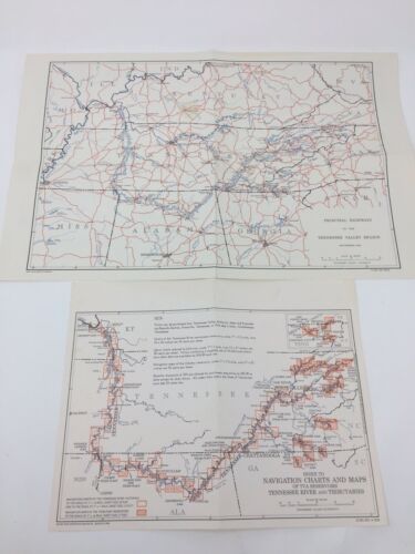
Tennessee Valley Authority Maps 1956 Principal Highways, 1958 Navigation Chart
$ 20.05
- Description
- Size Guide
Description
Vintage MapsItem: Lot of 2 Maps - Tennessee Valley Authority 1956 Principal Highways of the Tennessee Valley Region and 1958 Navigation Chart of the Tennessee River Waterway and Tributary Reservoirs
Features:
Condition: Very Good
Age/Year: 1956 and 1958
Size: 17" x 11" and 11" x 8 1/2"
Condition Issues:
Larger map folded in half and then half again
Smaller map folded in half once
Larger map has some
discoloration/spot
issues, 2 spots, one
located
in the upper middle left section, the other far right edge of the printed map in top section. Also some
discoloration
at the very top middle to right area outside the printed part of the map
Smaller map has a smudge top right area outside of printed area and a
discoloration
spot on the far left top edge of the map
Folded areas are in good shape, not tears or open cracks, but they do have some darker discoloration
Both maps have a distinct old book musky smell
